

ITINERARY 1
In the lands of the Brettii
A place that inextricably combines the mountain and maritime dimensions, as the name “Ionian-Silan Lands” perfectly reflects, in which the southern areas of the Sibaritide LAG are recognised. A borderland of peaceful cultural contamination and bloody colonisations and invasions… The journey along the Wellness Routes starts from here, from these towns with a multi-millennial history beginning as far back as the 15th century BC with the Oenotrians and Brettii civilisations: stubborn Italic peoples, inhabitants of the inland, strenuous defenders of their own identity in the face of the invasion of the Greek peoples coming from the sea and, later, of the Roman superpower, great builders of walls and defensive systems, megalithic testimonies of their immense effort of resistance which still mark the territory and represent the ideal thread of our itinerary.
Map
Technical specifications of the route
9
Locations
35
Travel distance
10
Points of interest
ITINERARY 1
Description of the itinerary and stages
Stages
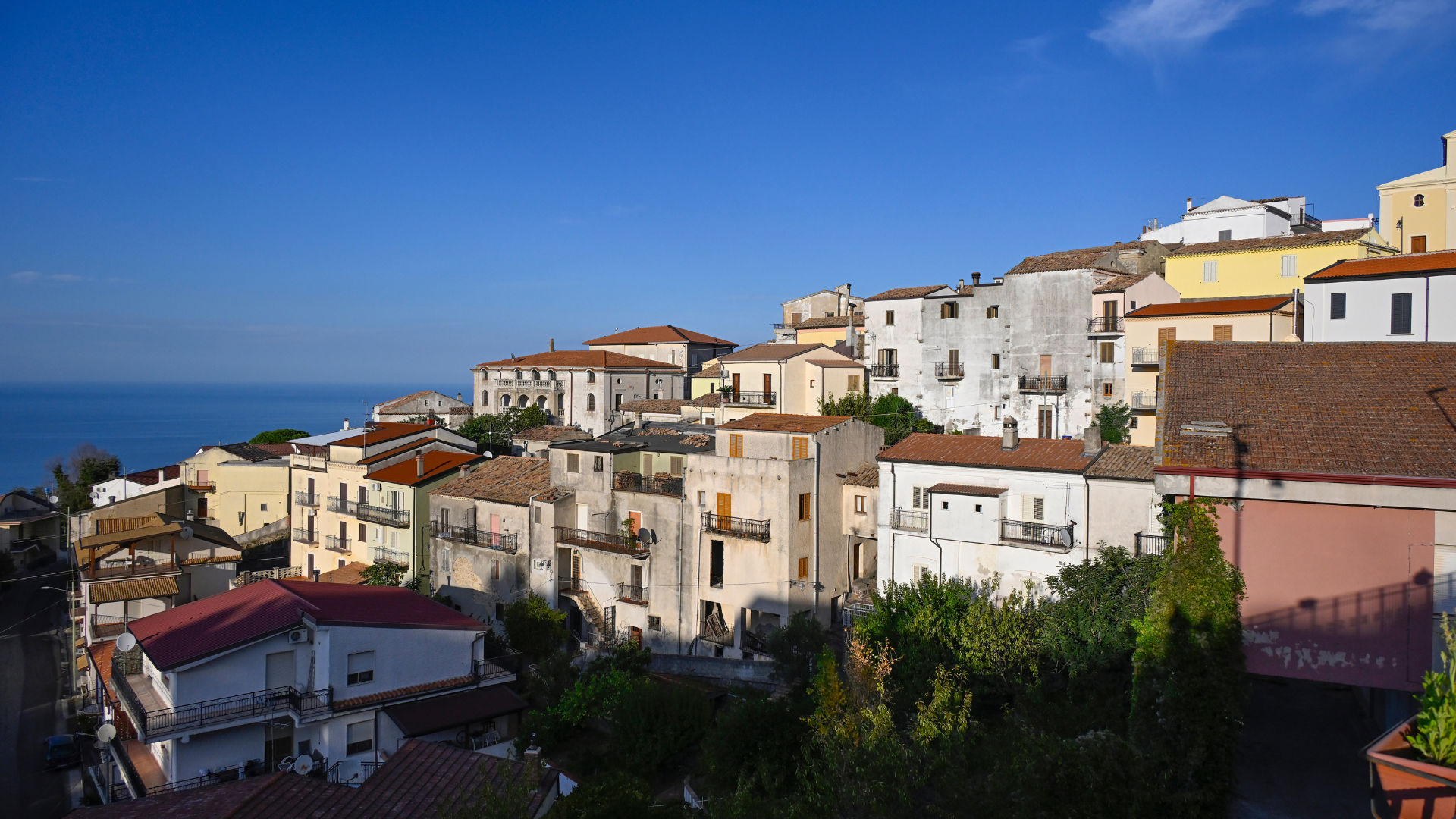
Cariati: axe masters and warrior princes

Our journey begins in Cariati, one of the southernmost municipalities in the Sibaritide LAG area. Let’s start from its Marina, from those beaches where the pebbles carried downstream by the endless flowing of the torrents become fine sand, the joy of bathers who flock to the lidos every summer, and the land where, in the waters in front of the town, a sumptuous posidonia oceanica (Neptune grass) prairie thrives, a refuge for an extraordinary biodiversity of animal and plant species.
The presence of the mountain area can already be felt on this marine horizon. You can see it clearly in the promontory on which the ancient village of Cariati is perched, a real natural fortress which became a strategic military stronghold in Byzantine times. And you can smell it, too. With a little attention and luck, in fact, you can smell the scent of the Sila larch pines, the raw material used to build the fishing boats that the town’s axe masters still manufacture today, perpetuating traditions that go back over the centuries, all the way back to the Roman Empire, which, from the great forests of the Sila, drew the planking and masts of the ships that ploughed the Mare Nostrum, as well as the precious “Brettia pitch”, also praised by Dionysius of Halicarnassus for its incomparable waterproofing qualities.
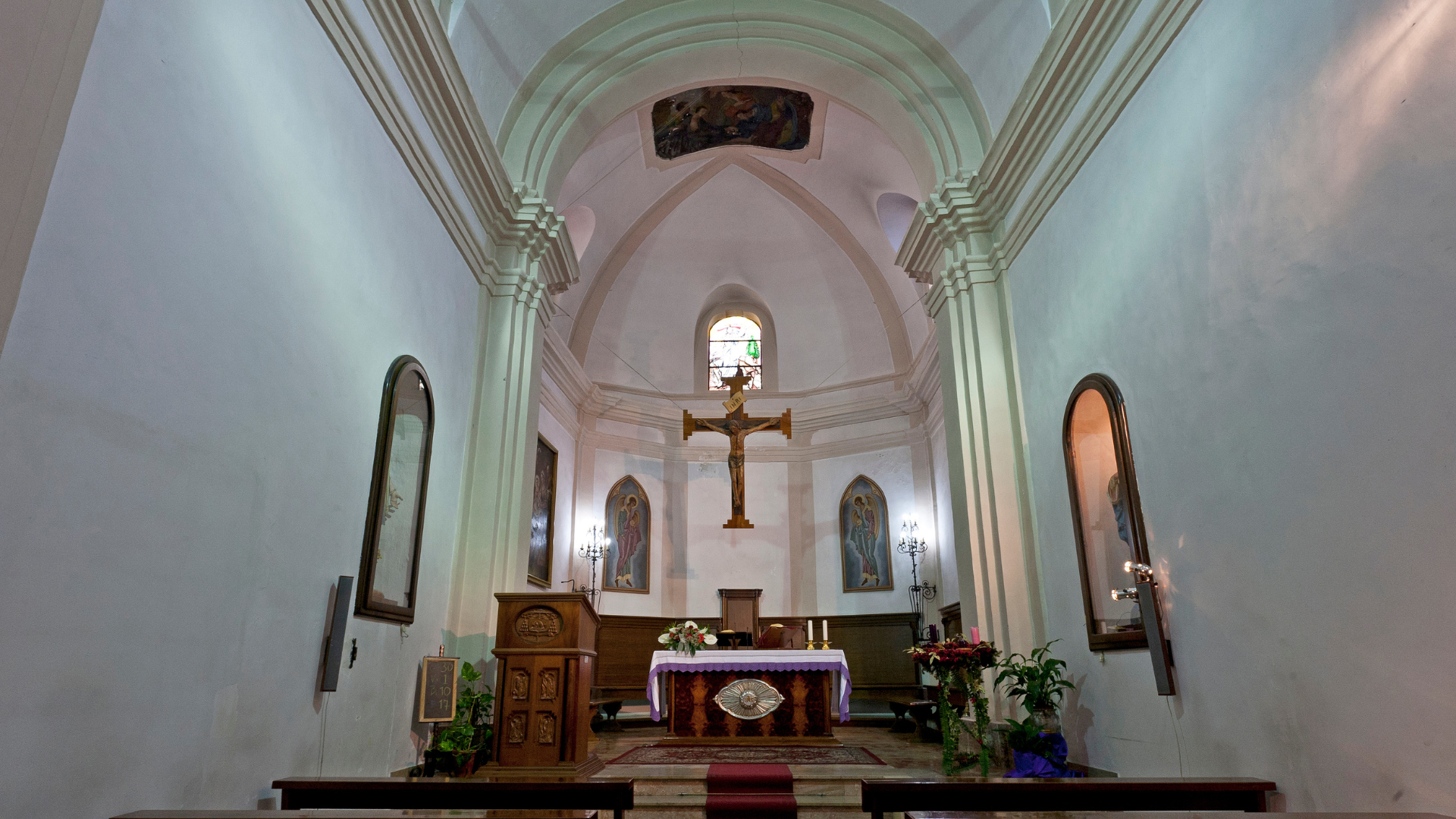
A visit to the historical centre is not to be missed. The mighty 15th-century walls that surround it, reinforced by cone-shaped and polygonal towers, can be entered through the beautiful Porta del Ponte Nuovo (New Bridge Gate), leading to the main street which then branches off into winding alleyways, rich in historic buildings and churches, such as the Bishop’s Palace, Palazzo Venneri (now the town hall), the Cathedral, the Church of the Observants and the Church of the Holy Trinity.

Before leaving the village, a taste of the local seafood specialities is a must, such as the “alici scattiate” (or “splashed” anchovies) or the peppered and salted anchovies, while from the garfish family come the “costardelli” (Atlantic sauries), prepared with fresh tomatoes and peppers. Then there is the famous “sardella”, also known as “rosamarina” and “novellame”, a savory sauce made of whitebait and chilli peppers, combined with many local recipes as a condiment for first courses, or offered in the form of a spicy cream.
Now it is time for us to make our first encounter with the evidence of the Brettian civilisation. In order to do so, we follow the SS 106 highway south-east in the direction of Reggio Calabria. Soon, in the locality of Cozzo del Salto, overlooking the Nicà river, we find the tourist signs for the so-called Tomba del Guerriero (Tomb of the Warrior). Here, in 1978, a chamber tomb was brought to light, built of sandstone slabs and with a rectangular layout, still adorned with various decorative details and remains of plaster. Inside was a precious treasure, consisting of a bronze armour, a diadem and other grave goods (now kept at the Sibari Archaeological Museum), a probable sign that the tomb was that of a high-ranking Brettian warrior.
Along the path leading to the Tomba del Guerriero, other testimonies of Cariati’s centuries-old history are encountered, such as the imposing castle that belonged to the Venneri noble family.
Terravecchia: the freedom elm and the Pruija Archaeological Park
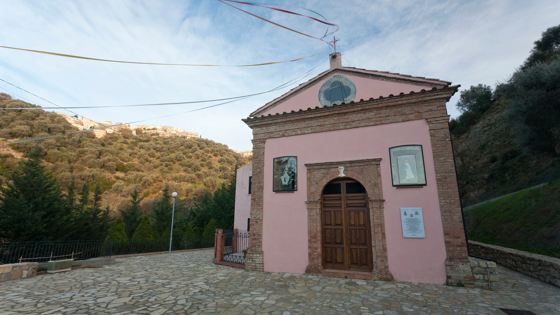
After returning to Cariati, our journey takes us inland. Following the winding route of the SS 108ter highway, we begin to climb towards Terravecchia, a village of probable medieval origin, built around the castle and located on a rocky promontory. Its dominant position over the valleys, whose view extends as far as the sea, made it an important sighting point for invading armies from the sea. The steep streets of the town centre are those of a typical mountain village, still strongly linked to traditions and religiousness. Particularly heartfelt is the devotion to the Madonna del Carmine, to whom the small rural church of Saint Mary is dedicated; here, an evocative fresco is preserved of the Virgin, who, according to tradition, saved the town’s children from the ambushes of a terrible reptile that kidnapped and devoured them.
The tumultuous wind of Enlightenment and egalitarian ideas also arrived in this remote southern village during the Napoleonic era. Proof of this is “L’Urmu”, the centuries-old elm tree that still thrives in the central square, planted in 1799 to celebrate the establishment of the short-lived Neapolitan Republic. The Terravecchia Elm is one of the very few “freedom trees” that survived the subsequent restoration of the Bourbon kingdom and is now included in the list of Italy’s monumental trees.
Due to their panoramic position, the heights around Terravecchia were, from the earliest times, a pivotal point of defence and observation systems. In the Pruija Archaeological Park, which can be reached from the village by driving for a few kilometres along Via San Giovanni and also extends over the territory of Cariati, there is an imposing city wall and the remains of a circular-based tower of Brettian origin.
After visiting the archaeological area and before leaving Terravecchia, it is a good idea to stop and quench your thirst at one of the three ancient mineral springs located near the town, the Papanicola, Santa Maria and Jisterna water springs, which have been restored and enhanced in recent years by the local administration also through the creation of interesting nature trails.
Scala Coeli: a stairway to heaven

Which is the route to continue our journey towards the innermost parts of the Brettii lands is not difficult to understand: Via Sila is the name that marks the SS 108ter highway, and which we follow to head towards Scala Coeli.
Along the itinerary, a place of greenery and peace invites us to a further stop. This is the Bosco di Verro, a typical Mediterranean hillside oak forest melting into the nearby pine forest, environments where it is not uncommon to spot various species of the local fauna: wild boars, foxes, dormice and hawks.
Scala Coeli, literally “stairway to heaven”, welcomes us with a view worthy of its name. In fact, the village stands on a steep cliff, almost perched on a staircase that seems to climb towards the sky… even if the Byzantine Greek root of the name seems rather to refer to the term Skàla Coèle, or “concave staircase”.

Whatever its origin or purpose, it surely is an impassable and difficult-to-access staircase. Since its creation, which some attribute to the Oenotrian and Brettian peoples, while legends refer to the heroes of the Trojan War in exile, Scala Coeli has been an impregnable fortress, becoming, during the Byzantine and later under the Norman domination, a safe refuge from Saracen incursions. Still during the 19th century, the priest and poet Vincenzo Padula described the place as a “walled hill…, surrounded by cliffs and caves”, which could only be accessed through four gates that were opened at dawn and closed at dusk…
Parts of the ancient walls still remain as a reminder of this warlike and stormy past, along with the austere bulk of the Palazzo Maiorano, which locals still refer to as “il Castello” (the Castle).
Before leaving the municipal territory, the most attentive and willing explorers can indulge in a visit to Borgo di San Morello, a truly fascinating and well-preserved village, which can be reached by taking a 4-kilometre deviation towards the coast along the SP 200 provincial highway.
Mandatoriccio: the land of pipes

Once our visit to Scala Coeli is over, we take the road again uphill. The SS 108ter highway is the connecting thread of our journey, as far as the junction with the SP 205 provincial highway, which we take to the right. We thus enter the territory of Mandatoriccio.
The municipal area extends all the way to the coast, where the modern settlement of the Marina offers services and refreshment to the many visitors to the beautiful Ionian beaches overlooked by the imposing structure of the Torre dell’Arso (Arso Tower), with its characteristic “sail-like” façades.

The historical heart of Mandatoriccio, however, is in the mountains, in the village that grew up around the castle built by Marquis Guidasso between the 15th and 16th centuries and which now houses the town hall. Along the central streets, there are plenty of places that preserve the area’s ancient traditions, such as the workshop of the craftsmen Carlo and Vito Carlino, masters of the local art of pipe-making, appreciated all over the world. Traditional flavours and recipes are also a treasure trove here, carefully guarded. The “cavatelli” are one of Mandatoriccio’s most typical products, protagonists of a highly appreciated festival held every year in early August.
The town also offers the possibility of interesting nature walks, such as the one that winds along an ancient Brettian path and leads to the Cessia spring; or the Montagnella path, which offers a relaxing walk among poplars and chestnut trees as well as a suggestive view over Campana, Scala Coeli and Pietrapaola.
Pietrapaola: the caves of the Basilian monks and Hannibal's Walls

Pietrapaola is the next stop on our journey through the lands of the Brettii. Just over three kilometres separate it from Mandatoriccio, along a quiet little road that runs among the hills and, once again, allows us to savour the dual soul of this territory. On the left, upstream, you can glimpse the extreme offshoots of the great Sila forests, dominated in altimetrical progression by oaks, then chestnuts and finally larch pines. All around, and as far as the eye can see down towards the coast, is instead a jubilant Mediterranean countryside: vines, fruit trees, fields and olive groves, from which sprout the area’s excellent food and wine products such as the Bruzio PDO extra virgin olive oil.
Pietrapaola bears written in its name the wonder that astonishes the visitor: the village is in fact built on a stone (“pietra” in Italian) framework, and indeed its oldest root is embedded in the rock itself. Towers, sheer walls and caves are the terrain that shapes the outline of the village and it was there that those who were probably its first inhabitants settled. In those difficult-to-access reliefs and in their natural cavities, from the 8th century onwards, Basilian monks from the East found refuge. As solitary ascetics or united in small communities, they devoted themselves to meditating on the sacred scriptures and worshipping the images of the Virgin and the saints, forbidden in their homeland by the persecutions of the iconoclastic policy of the Byzantine emperors.

The most astonishing of the Basilian caves in Pietrapaola is the large Grotta del Principe (Prince’s Cave), located on the Rupe del Salvatore (Saviour’s Cliff), which can be accessed via a steep flight of steps carved into the solid rock.
The Timpa del Castello (Castle Top), on the other hand, is the massive natural tower on which, subsequently, rose the feudal manor under whose wing the town later flourished.
Following the winding streets of the village downhill, we reach the elegant vault of the Arco del Colonnello (Colonel’s Archway), once one of the main gates of the town, overlooking the road that descended towards the Acquaniti valley, an ancient mule track made with river pebbles, traces of which can still be seen.
We, too, continue our journey towards the coast, driving along the hairpin bends of the SP 199 provincial highway until we come to a secondary road that branches off to the left, with a tourist sign for Hannibal’s Walls. What awaits us is another evidence of the Brettii’s skill in building large defensive fortifications, one of the most imposing in the entire Ionian-Silan area: a megalithic wall that stretches straight for more than 400 metres through the thick Mediterranean scrub. The connection between the structure and the famous Carthaginian leader is probably only a fictional one, the result of local legends. What is certain, however, is that the great general stationed his army in these areas during his raids on the Italian peninsula, finding precious allies in the Brettii in the fight against Roman domination.
Calopezzati: the sea sentinel

The SP 199 provincial highway leads us to the coast, an ideal place to enjoy the most relaxing and carefree atmosphere of the Wellness Route in the lands of the Brettii. Here too, the beauty and variety of nature are prominent. Arriving in the municipality of Calopezzati, we find ourselves in the presence of the charming Dune di Camigliano (Camigliano Dunes), a SCI (Site of Community Importance) area located near the mouth of the Acquaniti river. The site not only adds value to the natural heritage but also enriches the historical context thanks to the presence of a villa, which attests to the early settlement of the Romans in the Brettian landscape.
Continuing north along the coast, we come in sight of the village of Calopezzati, on top of one of the last hills before the plain and the sea. Its most characteristic feature is the imposing Castello Giannone (Giannone Castle), built in the Norman era on the remains of an earlier Byzantine fortification. Over the centuries, the manor was transformed from a simple fortress into an elegant noble residence. Between 1500 and 1700, the Sambiase noble family enriched it with decorations and libraries, new ceilings, fireplaces, a hall of honour and a drawbridge. Today, the fortress is owned by the Giannone family. Not far from the town is the structure that once housed the Convento dei Riformati, one of the most important monasteries in the Ionian-Silan area. The convent, a masterful example of the Baroque style, was unfortunately spoilt and reduced to a ruin by fires and earthquakes, until its restoration in the 1980s returned it to its ancient beauty. The former convent now houses a luxurious accommodation facility.
The imprint of Baroque art also characterises the Chiesa Matrice (Matrice Church), but to fully enjoy the charm of this small centre, the best thing is probably to take a walk through the alleys. Those who come here during the Christmas period can witness the magic of the living nativity scene, a tradition that is now deeply rooted, when the entire village is transformed into a large outdoor theatre: ancient craftsmen peep out from the characteristic shops; housemaids carry tables with bread to be baked balanced on their heads, the men drink wine in the taverns, the blacksmith strikes the iron on the anvil and the “trappitari” are intent on grinding the last olives.
The village is also characterised by the presence of numerous ancient fountains, often placed in picturesque and characteristic corners. One of the most important for the history of the village is the Scrimugno Fountain, built on a site previously occupied by the Basilian Monastery of St. Nicholas, a place chosen for its proximity to waterways, essential for the life of the monks. The presence of the monastery, which emerged in the 12th century, testifies to the continuity of a spiritual vocation in the area, fundamental for the religious and civil community of Calopezzati.
Crosia: before the immensity of the Trionto river
Resuming our journey down the coast, along the SS 106 highway, we pass by the massive 16th-century Santa Tecla Tower, another example of the fortifications that over the centuries have scanned the sea and defended populations from Saracen invasions.
After a few kilometres we arrive at Mirto, a populous hamlet of the municipality of Crosia and a popular centre for maritime tourism. It is not only the bathing facilities, however, that capture the visitor’s attention. Indeed, the town lies to the right of the mouth of the Trionto river, a spectacular example of those torrents that represent one of the most powerful manifestations of nature in these places. The beaches of Mirto, with their sand dunes, are another element of great natural interest, protected by the establishment of the Macchia della Bura Site of Community Importance. Another SCI is the Cento Fontane spring, also near the hamlet, where one of the largest springs in southern Italy emerges at flood plain level.
Mirto is also home to an important experimental centre of ARSAC, the Regional Agency for the Development of Agriculture in Calabria, dedicated to the tradition of silkworm breeding and mulberry cultivation, once particularly widespread in this area.
Like many other towns in the Ionian-Silan lands, Mirto also has its ever-present castle, imposing and evocative, although partially abandoned. In fact, it is not a structure built for exclusive military purposes, but a large fortified farmhouse, around which a self-sufficient agricultural community once revolved, even capable of providing for its own defence, thanks to the thick walls that encircled it.

Following the SS 531 highway, which runs along the course of the Trionto river, we enter the plain that, in 510 B.C., was probably the scene of the epic clash between the armies of the Magna Graecia cities of Sibari and Crotone.
With the arrival in Crosia, the journey through the geography of this area takes us even further back in time. Legend has it that the town was founded in 1315 B.C. by Aeneas and his companions fleeing from the burning of Troy, who wanted to dedicate it to Kreusia, the wife of the Virgilian hero.
Crosia today welcomes us with its typical medieval village appearance, with its winding alleys and beautiful churches, such as that dedicated to Saint Michael and to the Madonna della Pietà (Our Lady of Mercy), the object of particular devotion following the miraculous event of 1987, when, according to some, the statue depicting the Virgin Mary began to weep and speak to two local youths. For some years now, the town’s historic centre has been the subject of major enhancement works, such as the recent renovation of the historic Palazzo de Capua, soon to become the site of the civic museum.
Not far from the town, reached by following Via Carducci, are the ruins of the Càsino della Vota. Immersed in wonderful natural surroundings, this place is worth a visit as a testimony to the traditions and history of the area. Similar in structure to the castle of Mirto, the “càsino ‘a vota” was an ancient self-sufficient farmhouse owned by the noble families of Crosia, who also used is as a winter residence, as its name, meaning “sheltered place”, attests. The oil mills that can still be found on site are a sign of the once flourishing economy linked to olive processing.
Caloveto: on the trail of Saint John Calybite

Leaving the town of Crosia, following the SS 531 highway, we again head inland and towards the heights of the Sila Greca (Greek Sila), eventually arriving at Caloveto, an ancient town equally rich in history, which was first settled in the 9th century, when a group of monks, fleeing the iconoclastic persecutions, settled there, digging an ingenious system of tuff caves at the foot of the cliff above which the houses of the small village now stand.
It is precisely to these monks, followers of the teachings of John Calybite, a saint born in Rome in the 5th century, but whose preaching took place mainly in Constantinople and in the regions of the Eastern Roman Empire, that the town owns its name, which first became Caliviti, in the Calabrian dialect, and then Caloveto.
The heart of the historical centre is the church dedicated to the patron saint, Saint John Calybite, built during the 14th century at the behest of the Sangineri family, which today features a sober gabled façade with a beautiful pointed arch portal surmounted by a central circular rose window. Near the church, it is also possible to visit the small but interesting Museum of Sacred Art that houses precious objects from the period between the 17th and 19th centuries.
All around unravel the ancient alleys, overlooked by the town’s other sacred buildings and noble palaces from the feudal period. Of particular interest are Palazzo Comite, an 18th-century building located in the heart of the historic centre, which incorporates a characteristic covered courtyard and a cave carved into the rock, and Casa Caruso, built on a rocky hill, overlooking the valley below, which shows clear signs of the ancient agricultural activity related to olive processing: oil presses, millstones and other traditional equipment.
Before leaving the municipal territory, it is certainly worthwhile to take an excursion to the nearby Cozzo Pupatolo which, surrounded by a delightful natural setting, once again allows us to rediscover the signs of the Brettian civilisation, surfacing in the archaeological findings in the Cerasello locality.
Cropalati: the ancient Roman “Castrum Cropalatum”

From Caloveto, following the road bridge that crosses the Trionto river and offers a full view of the great torrent, we soon reach Cropalati.
The territory of this municipality is a concentration of many naturalistic attractions. On the mountains that rise behind the town pleasant hikes can be enjoyed, while the narrow gorges of the torrents are the terrain of exploration for canyoning enthusiasts. The secondary roads and dirt tracks that wind their way through the heights are also ideal for cycling and mountain biking tours.
The vantage position along the Trionto valley has made these heights a strategic point garrisoned since the time of the Brettii. To these or perhaps other populations of more ancient times we owe the creation of the “lithic globe”, the mysterious rock sphere dated around the 11th century B.C. and today placed at the entrance to the town centre. The Romans also established their “Castrum Cropalatum” here to control the transhumance routes as well as the silver extracted from the Silan mines of Longobucco. The Byzantines followed their example, and it was from their stronghold that the present town of Cropalati developed, experiencing its greatest splendour from the Middle Ages onwards.
The central position of Cropalalati and the prosperity of the village also benefited the surrounding countryside, where flourishing rural communities sprung up around the farmhouses or “casini”, such as the one that can still be admired in the locality of Sant’Isidoro, one of the best preserved in the entire Ionian-Silan area.
Today’s Cropalati keeps alive the memory of ancient traditions, such as that of ceramics manufacturing, well represented by the Fornace Parrilla (Parrilla Furnace), located just outside the town.
The alleys and squares of the village, full of history and unique atmospheres, are the stage every summer for the “Back to Cropalati” event, dedicated to art, writing, theatre and music, with the participation of artists coming exclusively from the south of Italy, who share a workshop of experiences and suggestions.
Along the SP 250 provincial highway we now descend into the valley at the bottom of which the clear waters of the Coserie torrent flow. On the opposite side, the road meanders through the hills where woods alternate with olive groves and vineyards.
At the boundary of the municipal territory of Cropalati, we come to a road that branches off to the left with signs for the Church of Santa Maria ad Gruttam, evidence of the presence of Basilian monks in this area, housing an ancient Byzantine icon of the Virgin Mary with Child, frescoed on the wall of a tuff cave.
Paludi: the mighty stronghold of the Brettii

Once back on the provincial highway, a couple more kilometres of bends take us to the town of Paludi. There are several points of interest in this characteristic village, from the religious architecture, such as the Chiesa Matrice devoted to Saint Clement (where two valuable paintings by Onofrio Ferro, a painter active in the mid-18th century, are kept) to the Museo della civiltà contadina (Museum of Rural Culture), which allows a proper reconstruction of the origins and local history through a collection of tools, instruments and materials of all kinds.
Those lucky enough to come to the village between the end of July and the first days of August can also enjoy the specialities offered by the Porchetta and Scoratello Festival, accompanied by the performance of the “Cavallo pirotecnico” (Pyrotechnic horse), a papier-mâché quadruped surmounted by a person dancing the tarantella, on which fireworks are lit. Moreover, in every season of the year, a tasting of the prized meats of the black pig, typical of the Ionian-Silan area, from which the sausages that best express the strong character of this land are obtained, is a must.
To discover the most precious treasure of tradition and culture in the Paludi area, however, we must leave the town centre and follow the signs leading to the Castiglione Archaeological Park, probably one of the most spectacular parks in the whole of Calabria, both in terms of size and magnificence of the findings. Right here stood one of the largest strongholds from the Brettian period, dating back to the 4th century BC. A settlement covering more than 35 hectares, of which archaeologists have uncovered the large walls together with the eastern gate and the circular towers.

According to the hypotheses formulated in the 1980s by the historian Pier Govanni Guzzo, and also supported by subsequent research, the Brettii had probably established an organic system of fortifications that, through various observation and surveillance points, allowed communication between the three great bastions represented by Castiglione, the so-called Hannibal’s Walls in Pietrapaola, and Purija di Terravecchia.
The marvel of Castiglione, however, does not end here: a little further downstream from the Brettian fortifications, near Piano Agretto, excavations have in fact uncovered the remains of a large necropolis dating back to the Iron Age (10th-9th century B.C.) and to the civilisation of the Oenotrians, the very first inhabitants of the Sila Greca.
In front of these majestic megalithic relics, our journey through the lands of the Brettii comes to an end. All that remains is to return to the village of Paludi to take the SP 250 provincial highway and follow it to the gates of Rossano, where another adventure along the Wellness Routes of the Sibaritide LAG can begin.
All points of interest
Cariati: axe masters and warrior princes

These watercourses, typical of the Calabria region, are characterised by an essentially short course, a very wide and pebbly bed, raging waters during the winter and autumn, and a very low flow as well as relative placid motion for the rest of the year. The upper stretch of these torrents often has characteristics not dissimilar to an Alpine or Apennine torrent, so that it often runs through ravines, also forming picturesque waterfalls and gorges. The Trionto river, counted among the largest torrents in Europe, has in some places a bed more than a kilometre wide. The formation of these fluvial systems is also linked to the geological peculiarities of Calabria, which is considered a fragment of the Alpine chain detached, together with Corsica and Sardinia first (with the formation of the Ligurian Sea) and alone later (with the formation of the Tyrrhenian Sea), following a process of plate drift in the Mediterranean Sea that began about 20 million years ago, until the current conformation, reached about 2 million years ago.

It plays a fundamental role in the biology and ecology of the Italian seas: it is remarkable for its action in protecting the coastline from erosion, it oxygenates the waters, it provides shelter for numerous fish and is a nursery for eggs, larvae, small fish and invertebrates. Unlike seaweed, whose structure is not clearly differentiated, the Neptune grass, being a plant, has roots, stems and leaves, and produces flowers and fruits. Its presence is an indication of the good state of the environment: in all European Mediterranean countries, stretches of coastline rich in this plant, such as those along the Ionian coast of the Sibaritide, have been declared Sites of Community Importance (SCI).
Terravecchia: the freedom elm and the Pruija Archaeological Park

The Brettian settlement of Pruija di Terravecchia is a good example of the functionality of the fortified centres on the heights of the Greek Sila. Situated 400 metres above sea level, it guaranteed the control of the coast as well as of the Nicà river valley. It was only in the 1970 that scholars began to investigate the site. Particularly interesting is the study started in 1990, aimed at proving the theory already formulated by Pier Giovanni Guzzo in the 1980s, i.e. that the Brettii had created a real territorial defence system, characterised by an organic visual connection between the fortified centres. Pruija di Terravecchia was visually connected with the Hannibal’s Wall in Pietrapaola, and between these two sites, the settlement of Palumbo di Cariati acted as an intermediate station, while that of Cerasello acted as a visual link with Castiglione di Paludi, the richest locality in terms of Brettian and Oenotrian archaeological evidence.
Info and contact details:
Municipalities of Terravecchia and Cariati – Tel. +39 0983 97013 / +39 0983 94021
Pietrapaola: the caves of the Basilian monks and Hannibal's Walls

A spectacular sight awaits those who arrive at Pietrapaola, whose name, of Brettian origin, derives from Petrapia, meaning “place of the cliff”: in fact, an enormous cliff, called Timpa del Castello (Castle Top), majestically overlooks the settlement lying at its foot. At its side stands another imposing, more jagged rock called Rupe del Salvatore (Saviour’s Cliff), near which is the picturesque Grotta del Principe (Prince’s Cave). The site can be reached directly from the town via a flight of steps carved directly into the rock of the Rupe del Salvatore. The name probably derives from the fact that, unlike most of the nearby caves, this one is particularly large and well-kept. Three different rooms can be identified, characterised by the presence of openings that look like windows, niches and even small columns and capitals. The peculiarity which distinguishes it from other caves are the engravings carved directly into the rock, representing a unique example of rock art.
Info and contact details:
Municipality of Pietrapaola – www.comune.pietrapaola.cs.it

Located three kilometres from Pieatrapaola, the Altopiano delle Muraglie (Walls Plateau) overlooks Capo Trionto and Punta Fiume Nicà as well as some minor streams (Fiumarella, Acquaniti and Arso). It can be reached from the Pietrapaola station junction, on the SS 106 highway; following the provincial highway along the Acquaviti torrent, you turn right before the hairpin bends leading to the village, at a small bridge, taking a mule track that climbs south-west for about 2 kilometres. There, the wall will welcome you with its 450 metres in length, almost completely immersed in the dense Mediterranean scrub: this is the point where this 1.5-kilometre-long work from the Brettian era is best preserved. On the north-east side there is a gate with a corridor, while on the south-east side the base of a quadrangular tower is still visible.
Info and contact details:
Municipality of Pietrapaola – www.comune.pietrapaola.cs.it
Crosia: before the immensity of the Trionto river

In Mirto, in the municipality of Crosia, about 400 metres from the sea and 8 metres above sea level, emerges one of the largest springs in southern Italy at flood plain level. We are talking about the Cento Fontane spring, an aquifer front more than 200 metres long that rises from the loose soil, in correspondence with a morphological step, fed by the groundwater of the Trionto river. Before the urban transformations that began in the 1950s-1960s, there was a whole system of wetlands, alternating marshy and brackish areas, with flora and fauna characteristic of these environments, only partially preserved. The spring had a flow rate of 152 L/sec. (measured on the 28th of July 1934). In a print of the Calabria Citeriore of 1657, taken from the work by Matteo Greuter, this water front is referred to as “Cento Fontanelle”, but also “Cento Fonti” in other ancient cartographies, all meaning “one hundred fountains”.
Cropalati: the ancient Roman “Castrum Cropalatum”

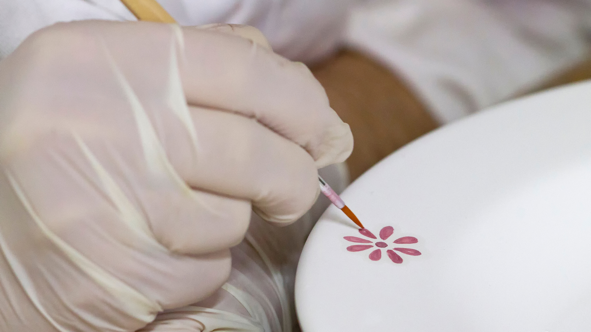
Among the ancient trades of the Ionian villages, a prominent place certainly belongs to the master potter. He was the one, in fact, who made numerous ceramic objects that were fundamental to houses and entire villages. Using clay, the master made vessels of all shapes and types for water, oil, wine, as well as for cooking and storing food. He also produced the bricks needed for the construction of houses as well as tiles for roofs (“ceramili”). Today, especially in Cropalati at the Fornace Parrilla, where the tradition has been maintained, it is possible to admire fine products destined to furnish and embellish homes and villages, such as ornamental tiles, plates, bowls and decorations of various kinds, decorated with delicate paintings.
Info and contact details:
Fornace Parilla – www.fornaceparrilla.it
Paludi: the mighty stronghold of the Brettii
The ruins of Castiglione di Paludi (the imposing Brettian centre of Kossa or, more likely, Etas), located on a hill of approximately forty hectares dominating the middle valley of the Coserie torrent, are still being investigated by the Archaeological Superintendence of Calabria which, together with the municipal administration of Paludi, launched an ad hoc project for the Archaeological Park in 2006. The area was inhabited from the 9th to the 3rd century B.C. and shows the remains of an Iron Age Oenotrian necropolis (9th-8th century B.C.), in the locality of Piano Agretto, as well as the more substantial remains of a Brettian fortified centre (4th-3rd century B.C.). The main entrance to the town was the Great East Gate, preceded by two large watchtowers and connected to the coast through the valley of the Coserie torrent; a “curtain gate”, since it was preceded by a passageway closed by high curtain walls, a system that allowed excellent guarding and double control for those entering the town. To the north, the round “gamma” Tower protected the north-eastern spur of the walls, facing the Ionian Sea. Along the northernmost section of the wall, a smaller tower (the “delta” Tower), featuring an internal staircase, was recently discovered. On the south-eastern slope of the northern plateau, a second entrance gate to the settlement opens: the South-East Gate, of the “simple corridor” type, which allowed access to the inhabited centre from the area of the assembly building, otherwise known as the “theatre” as it also has a cavea and a space for the orchestra, across the valley floor of the Sant’Elia torrent, today an SCI (Site of Community Importance) area. In addition to the ruins of this building, today it is also possible to see part of the so-called “Long Wall”, an imposing structure about 42 metres long and 4 metres high, which had a soil retaining function.
Info and contact details:
Municipality of Paludi – www.comune.paludi.cs.it; Tel. 0983.62029

The Oenotrians were the first inhabitants of the Sila Greca. The earliest indigenous human habitation of the entire area dates back to the 15th – 8th centuries B.C., from the Bronze Age to the Iron Age, as evidenced by the remains found in Piano Agretto, in the Archaeological Park of Castiglione di Paludi and downstream of the city walls. There are about 50 pit tombs, bordered and covered with river pebbles, with grave goods dating from the late 10th century to the second half of the 8th century: bronze and iron spearheads, jewellery and ornaments, knives and razors. These are traces of the Oenotrians, an Italic people who preceded Greeks, Brettii, Romans and Byzantines in these lands.
Info and contact details:
Municipality of Paludi – www.comune.paludi.cs.it; Tel. 0983.62029
